WARMER DAYS HERE AGAIN...
- Dec 28, 2022
- 3 min read
Hey everybody, time to play fun with temperature departures. If you've been playing along recently, you know very well the past 7 days have been dominated by Arctic air and well below normal temperatures. Here's the departures to prove it.

This is the 500mb jet stream pattern that caused the cold.

Now, look at what the 500mb pattern looks like the upcoming 7 days. Instead of the trough over the Great Lakes delivering frigid air, it retrogresses to the west with a ridge building over the Great Lakes. Cold is cut off as the jet gets aligned in what's known as southwest flow. That will see to it that temperatures are moderate by January standards.

Here's the forecast temperature departures off the EURO for the next 7 days. December 28th-January 4th. Seriously, the recent cold is nowhere to be found as it has evacuated most of North America.

For the purpose of comparison, compare the coming 7 days above to the previous 7 days. Night and day to say the least.

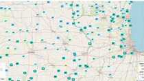
Ready or not it appears our January that is coming and we'll get to taste even in the last days of December. Check out these highs that are projected December 29th. Upper 40s in my northern counties and nearly 60 in the far south. Mid 60s in Missouri!

The next 10 days look like this in the Quad Cities by way of the EURO meteogram. That's a heck of a start to January, typically the coldest month of the year.

Another aspect of SW flow is that it does bring moisture to much of the nation, the key ingredient necessary for precipitation. Over the next 16 days the GFS indicates this for total amounts. Some really nice rain and snow is shown over the west which very much needs the moisture.

Despite the influx of moisture, the storm track currently is such that most of the heavier rain or snow splits and bypasses my area to the NW or SE. Here's the precipitation departures for the next 16 days ending January 12th.

As you would expect with the cold air gone from the picture, snow is not going to be much of a commodity (if at all) over the eastern half of the country. Even what falls over the upper Midwest is light and below average for the 16 day period.

If these wild fluctuations seem odd to you (we've being experiencing them since November), it's really not that unusual in a moderate to strong La Nina. As you can see a La Nina of that caliber has two distinct phases. The cold phase we just went through with the northern branch of the jet highly amplified, and the warm phase we are entering now with more of a W/SW flow allowing Pacific air masses to dominate.

As the graphic indicates the MJO is often the tip off for these drastic flips and sure enough that's the case now with the warm-up. Notice the rest of the month we are in phases 6 and 7 of the MJO and that extends through January 10th (the red dotted lines).

The temperature analogs for both of those phases are mild as you can see below.

After January 10th, the MJO is shown entering phases 8 and then 1 (the purple dotted lines).

Those phases are significantly colder and would signal that we come out of the mild weather around January 10-12th and enter a new period of cold for much of the rest of January.
Teleconnections such as the AO (Arctic Oscillation) and the PNA (Pacific North American Oscillation) also signal the change to colder solutions at that time.
The negative AO signals cold.

The PNA could be the biggest driver for cold as it goes significantly positive.

See how the positive PNA brings cold to the eastern half of the U.S.

Obviously that is down the road and for the next 8-14 days temperatures are on their way up. We get our first good taste of the thaw Wednesday with highs near 40 north to the mid 40s south. Sunshine will add to the pleasant nature of the day! Get the heck out and enjoy it! Roll weather...TS


Comments