


SUMMER MAKES A RESERVATION
COMPELLING EVIDENCE
If the weather charts could talk, they would be telling us to book reservations for some good old-fashioned summer weather by the solstice (June 20th, 2024). At least for now, the evidence is quite compelling that warm (to even hot) sultry conditions are in the making. They won't reveal themselves for more than a week, but if I'm reading the tea leaves right, the first 90s will soon be packing their bags for the Midwest. More on that in a minute.
I don't want to get too far ahead of myself though, as the next week looks comfortable by June standards. Northwest flow will continue to dominate the upper level flow, keeping any heat locked up over the southwest. Here's the 7-day temperature departures for the period June 8-15th.

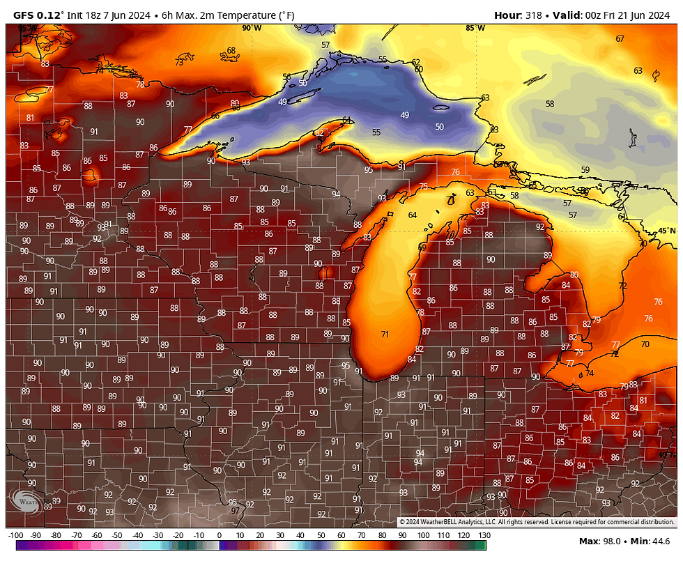
The GFS indicates only one day between now and June 16th with a high of 80 or above in the Quad Cities. Then you can see the heat builds, with 3 days in the 90s starting the 20th.

Prior to that, the relatively cool air of the next week will be accompanied by a NW flow disturbance that ripples southeast Saturday, with two areas of forcing. The first and strongest is tied to warm advection showers and a few storms. These fired in western Iowa Friday night, and what is left of the complex cuts across my far southern counties Saturday morning. By far the heavier amounts are found in Missouri, but some totals of 1/4 inch or less may catch the SE corner of Iowa or WC Illinois.
Another area of rain associated with a deformation band develops further north and could bring another swath of 1/4 inch rains to parts of my counties near and north of I-80. The CAMS (convective allowing models) are the most bullish on amounts from this swath of rain). The GFS and EURO show very little falling. I wonder if the stronger convection further south in Missouri will rob moisture that would otherwise fall as rain. That may be why the EURO and GFS are so much lighter. Either way, the amount of rain that falls in my central and northern counties is the wild card of Saturday's forecast. Here's what models are showing. I'll start with the lighter EURO and GFS, which I feel has the most merit.
The EURO

The GFS

The hi-res Canadian GEM

The CAMS are substantially wetter in my northern counties. Normally the hi-res CAMS at this distance are fairly reliable, so I have to give them respect, but I do question them in this situation for the reason stated earlier. The 3k NAM seems to be an outlier and overly excessive. No matter what, either the CAMs, or the deterministic EURO/GFS solutions are going to be wrong.
The 3k NAM

The HRRR

The amount of precipitation and cloud cover could also have a significant impact on Saturday's temperatures. If the wetter set-ups prevail, readings in the north may not get out of the mid or upper 60s, while the south is in the mid to upper 70s. I'm kind of in between, with highs of 70 north to 75 south.
You may recall yesterday we had a situation for Sunday night and Monday where the GFS was the outlier with an amplified upper air low that dumped 1–3 inches of rain on much of my area. I thought that smelled bad and sure enough the GFS has reverted to the dry depiction of the EURO. Sunday should be a pleasant day, with partly to mostly sunny skies and highs in the range of 73-78 north to south.
For the most part, the majority of next week looks dry and comfortable. There may be some spotty showers and storms around Tuesday night and again Thursday night, but for now chances are no more than 30-40 percent and mainly at night.
Next weekend, temperatures begin to heat up as this ridge builds over the central U.S.

These are the resulting temperature departures for the first day of summer (June 20th)

That gives us highs around 90.
Even more influential are the dew points, which are shown building into the mid 70s. That should make for a nice head of steam that gives the air a tropical feel.

The next question that remains unanswered is do we get into a position where we reside on the northern periphery of the heat and humidity? That location, where the storm track resides, is known as the "ring of fire". It gets its name for being the firing zone for active thunderstorms that are often strong and heavy rain producers. That should become more apparent the middle of next week.
For now, enjoy your weekend and roll weather...TS
A VERY SOUND DEAL...
I have a great vacation deal going on at my AIRBNB in Galena. I'm offering 3 nights for the price of two to get the word out of what the church has to offer. We've also lowered our rates to beat the competition. Weekdays are an especially good value. Give Carolyn a call or text at 563-676-3320 to get the best deal for you and your group. Our renovated church is a 5 star, super host on AIRBNB.

AN EXCEPTIONAL OPPORTUNITY TO SAVE. A first come, first serve deal worth more than $300. Call or text Carolyn at 563-676-3320 to take advantage of this exceptional summer offer. With sleep accommodations of up to 10, you won't find a better value for this fully renovated 5 star super host AIRBNB in Galena. Call or text Carolyn at 563-676-3320 for more details.


תגובות