


ONE SAVING GRACE...
- rebeccakopelman
- Jan 20
- 1 min read
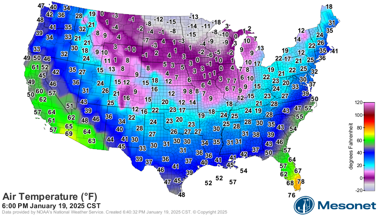
It's obviously cold. Temperatures were barely above zero Sunday afternoon and temperatures were dropping fast in the evening:
And when the wind is factored in that air, of course, feels much colder:
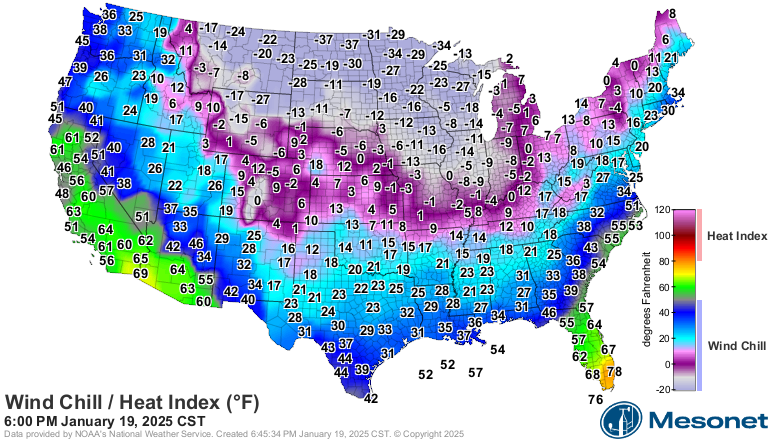
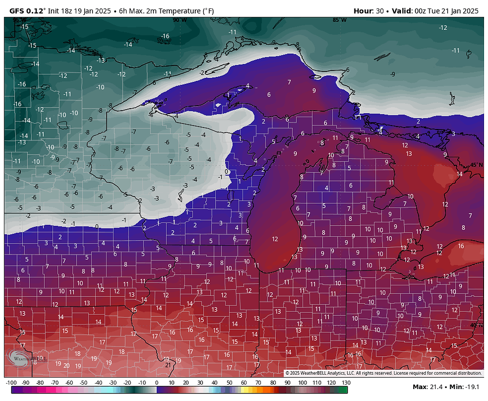
Oof! There is a clear difference where temperatures are significantly colder. While the core of the cold air is to our north, there's also snow on the ground sending those temperatures down even further.
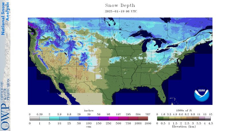
While we may be missing the white gold, the lack of snow is our one saving grace. Temperatures would be much colder if we had snow on the ground. Just for example, last year we had a considerable amount of snow on the ground. Look at the snow depth for January 14, 2024:
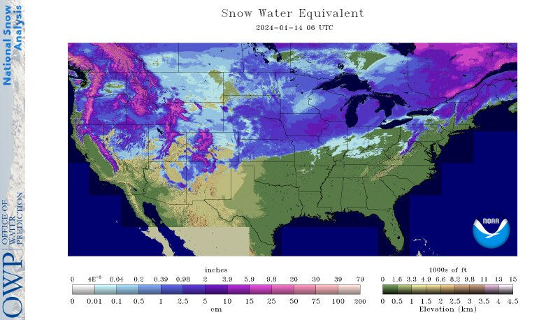
And temperatures were 15 to 20 degrees colder than what we're experiencing now. Plus, wind chills were at much more dangerous levels.


Still, it's been bitterly cold and will remain cold into the start of the week. And it's still the kind of cold that can lead to frostbite if you're not covered up.
Highs Monday will be in the single digits once again:
An arctic high pressure system will be directly overhead Monday night into Tuesday. That will send temperatures down even further:

Wind chills will be brutal and dangerously low Tuesday morning:

Temperatures will be in the single digits Tuesday afternoon, but the cold retreats and temperatures will be back around normal by Wednesday afternoon:

Temperatures will generally stay near freezing through the rest of the week.
Rebecca Kopelman


Comments