IT'S GOING DOWN FROM HERE....
Saturday was pretty nice, especially for a late November day. Temperatures were sitting 10 to 15 degrees above normal across much of the Upper Midwest. Here's a look at the high temperatures for Saturday:

That will be the warmest day we'll see around here for... a while. It may be the last 50° day of 2020 (maybe not, time will tell). The average date for the last 50° day comes around December 10th around these parts. We can still get 50s into December, but they do start to become less and less common this time of year.
What is certain right now is that it's going to get cold. It starts Sunday as a cold front begins to move through the region. Temperatures will be running 10 to 15 degrees colder than Saturday:

Winds will be increasing, too, and begin to pull down colder air and make it feel even colder at the same time:

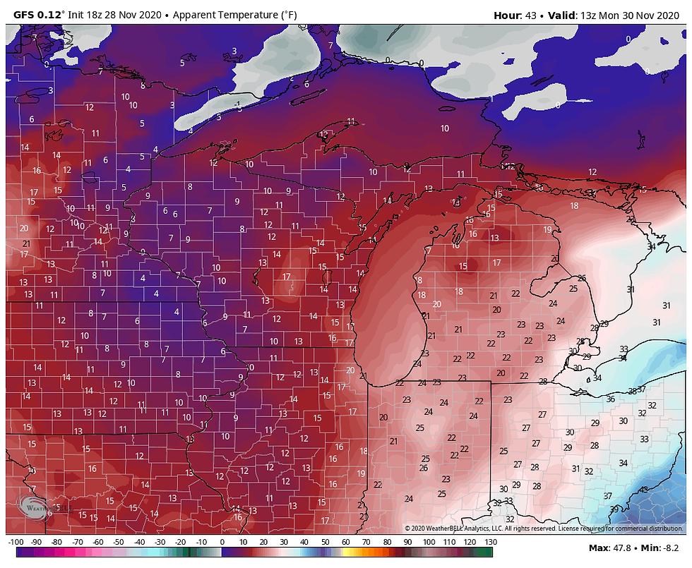
Temperatures will bottom out in the teens and 20s Monday morning:

And wind chills (what it feels like to your skin) will be down in the single digits with the wind still kicking:

There will be plenty of sunshine, but temperatures will struggle to climb Monday afternoon with the cold air in place:

So that's a ~25° drop in high temperatures from Saturday to Monday. What's happening in the upper levels is this trough gets carved out in the Upper Midwest/Great Lakes region and unseasonably cold air will result for early next week:

Temperatures will gradually rise through the week, but generally remain near normal.
RK


Comentarios