


AND HERE COME THE STORMS...
Rounds of showers and storms will move through the Midwest with an active jet stream sending disturbances through the region. A stalled boundary will be the focus for storms through Tuesday:

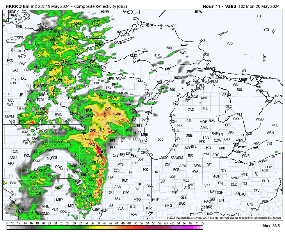
Overnight into Monday morning showers and storms will move across Iowa into Illinois. Some storms may be strong with gusty winds and some hail.
There may be some strong winds through western Illinois before sunrise. There's some uncertainty on how the remainder of the day shakes out - there could be some additional showers in the afternoon or it remans dry. Temperatures will be in the 70s to near 80:

Additional storms will develop in the evening and continue into Tuesday morning:

Warm air and moisture will be building and instability will grow during the day after the morning rain. Instability will be high:

Shear will also be strong, with winds increasing with height in the atmosphere. As a result the area is under an enhanced risk - 3 out of 5 - for severe weather.

Any initial storms would pose a tornado threat, but the concern is growing for damaging winds as storms form into lines Tuesday evening.

We'll have to watch how this evolves and comes together, but storms will maintain strength in the evening as the low-level jet kicks in to aid instability.
Rebecca Kopelman


Komentarze