ACTIVE BUT UNEVENTFUL
- terryswails1
- Dec 17, 2024
- 3 min read
Before we get to the weather leading up to Christmas, some quick comments regarding Saturday's ice event, which produced the first ice storm warnings out of the Davenport, Iowa NWS office in 658 days. The last one previous to this was issued February 22, 2023. On average, ice storm warnings (1/4" of ice or more) are issued by the Davenport NWS about once every three years.

Cedar Rapids, Iowa reported the highest ice accumulation with nearly 3/4 of an inch of flat ice (.68") at the Eastern Iowa Airport. Coralville and North Liberty not far away both reported half inch accretions. By the way, for those wondering, flat ice is the ice thickness measured on a flat service. Radial ice estimates the average ice thickness on a branch or wire.

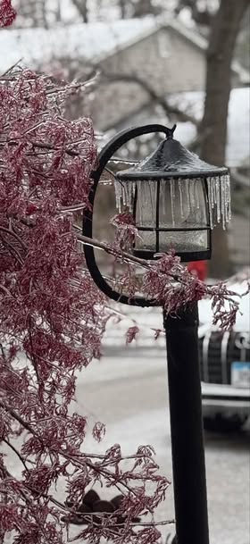
Ice accumulations of 1/4 inch or more were found from SW Wisconsin all the way through eastern Iowa into NE Missouri. Up to 30 percent of some SE Iowa counties temporarily lost power at the height of the storm. This image, provided by the NWS, shows heavy icing in Iowa City Saturday. It was captured by Jean Wiese.

Of course, the ice is all just a memory now, with Monday's highs ranging from the low 40s north to the upper 40s south. Here's a look at 3:00pm readings. Temperatures in southern Illinois were springlike, with highs in the low 60s.

HOLIDAY SALE AT OUR GALENA AIRBNB (CLICK BANNER)
40% off a weekend or weekday stay in December-February. Call or text Carolyn now at 563 676 3320
After the balmy conditions of Monday, temperatures will be down several degrees Tuesday due to the passage of a week cold front. In fact, the front turns stationary late in the day Tuesday, allowing a weak wave of energy to ride along it Tuesday night. From there, it may be strong enough to squeeze out some light snow Tuesday night, especially north of HWY 30 where there are some suggestions of minor accumulations of 1/2 of snow, especially closer to HWY 20. This is the first of 3 clipper like systems that will ripple across the upper Midwest in a progressive pattern between Tuesday and Saturday morning.
The second disturbance appears destined to take a more northerly track as it streaks across southern Minnesota into Wisconsin Thursday. This one has a little more meat on its bones and should lay down a nice 2-4 inch band of snow up that way. My area should remain largely dry, although a few snow showers may catch the far north. Temperatures should show a pretty good range Thursday, with low 30s in the north, to low to mid 40s in the swarm sector south of I-80.
As for snow, this is what models are suggesting for amounts from the first two systems combined through Thursday night. Most of this occurs with the second system later Thursday.
The EURO

The GFS

The Gem

Another clipper may squeeze out a few snow showers late Saturday, with one final chance arriving late on the 23rd. Despite the active pattern, none of the systems appears to be very impactful locally, with my northern counties most favored for light snow accumulations. If any one spot can manage an inch or 2 of snow in the next 7 days, I would say take it, you have done well in a year that has significantly lacked in snow production.
After the 23rd, the MJO finally gets into phase 6 for a time and does its dirty work. For those unaware, phase 6 in December is known to be mild. Here's what the temperature and precipitation analogs looks like.

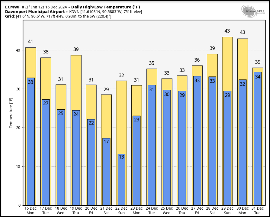
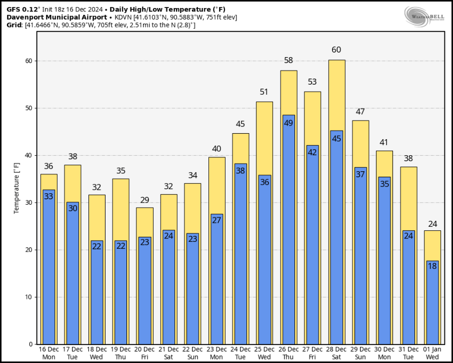
Here's what the deterministic EURO and GFS long range meteograms show through the end of the year. The GFS is really toasty, just beyond Christmas!
The EURO

The GFS

That's where things stand going into December 17th. I can't believe I still haven't had an inch of snow at my homestead in Dubuque. Here's hoping I can still squeeze out some white gold by Christmas. It's my wish and after all I've been a good boy! Roll weather...TS


Σχόλια