SEVERE WEATHER SEASON STARTS FAST AND LOOKS TO LAST...

The official numbers are rolling in and February was nice and toasty around most of the country. Here's the U.S. temperature departure for the month. As it appears now this year will be the warmest over the lower 48 in at least 37 years.

The unofficial data I'm looking at shows only 1954 to be warmer going all the way back to 1895.
What's interesting about '54 is that in much of Iowa February ended up as one of the snowiest ever. In Cedar Rapids, (when ironically 1954 was the third warmest on record), the month ended up with 17.8" of snow. That's 4th snowiest. The large snow total was primarily due to a 17.8" snowstorm that occurred at the end of the month.

Following the warmth of February 1954, March was anything but nice. The average temperature for March '54 ended up 5.5 degrees below normal and 7.7" of snow accompanied the cold.

What's it mean for March 2017? It difficult to say, however my feeling is the above normal warmth is likely to dominate as it has since January. With the warmth, and sea surface temperatures in the Gulf of Mexico at all time records, severe weather could continue to be a player that's more widespread and further north than than is typical in some parts of the Midwest.
Just look at these water temps in the Gulf. For the first time ever they never dropped below 73 degrees during the winter!
Going forward here's where the best chances of severe weather typically are in Mid-March and then at the end of the month. Notice the southern Plains and deep south is where most of the action is found. I would not be surprised to see a noticeable shift north in March and April this year.


The storm system that brought the first February tornado warning to the NWS office in the Quad Cities was quite amazing for its scope and northern latitude. Look at the storm reports for the past 2 days below. More than 600 reports both Tuesday and Wednesday (over 1200 total).


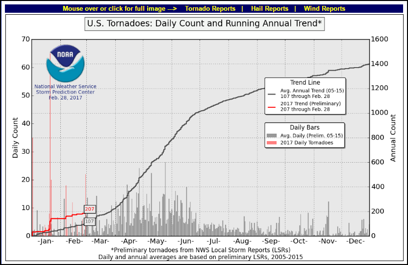
Going into March the tornado count is twice the average. With 23 fatalities it's also the most deadly start since 2011 when more than 550 deaths occurred. That was also a La Nina year like this.

While there's no way to know in advance, it's my thinking that with the remnants of a La Nina, a persistent east coast trough, a progressive meridinal jet, record warm SST's in the gulf (providing latent heat and moisture), and an active season so far, the odds favor a robust year for severe weather in much of the Midwest. Time will tell. Roll weather...TS


